EN
 TR
 DE

Mesopotamia Explained: Why Two Rivers Changed Everything
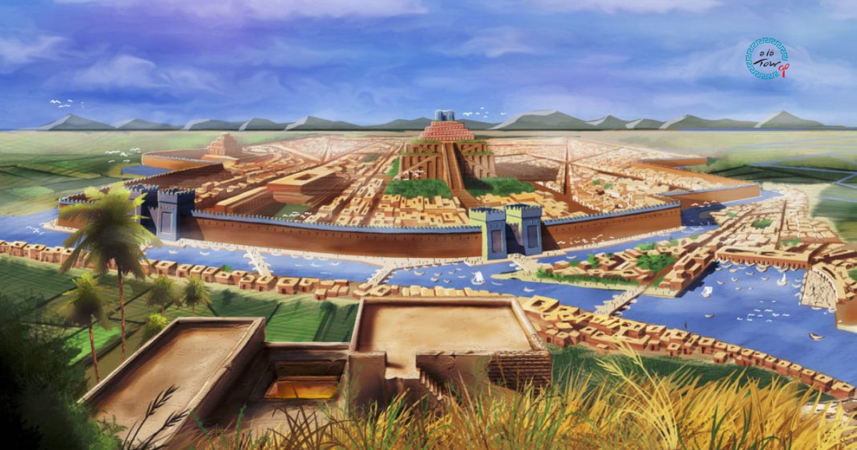
Mesopotamia is one of those words everybody has heard and almost nobody can place. It is not a country and never was. The name is Greek and simply describes a location: mesos between, potamos river. The land between the rivers.
The two rivers are the Tigris and the Euphrates. Here is the part that surprises most visitors: both of them rise in Turkey. The Euphrates begins in the mountains of eastern Anatolia and the Tigris not far from Diyarbakır. They run south through Syria and Iraq to the Gulf, but the top of Mesopotamia, the part archaeologists call upper Mesopotamia, is southeastern Turkey. When you stand in Şanlıurfa or Mardin, you are standing in it.
Why rivers mattered so much
The argument is simple. In a dry region, a river means you can predict where water will be next year. Predictable water means you can plant a seed and come back for it, and that single change pulls everything else behind it.
Settle down to farm and you produce more food than you eat. A surplus has to be stored, so you need buildings. Stored grain has to be guarded, so you need authority. It has to be divided, so you need accounting. Accounting marks on clay become signs, signs become writing. Within a few thousand years you have cities, kings, temples, armies, taxes, written law and almost everything else we mean by civilisation.
That chain is why so many firsts are dated to this region: the first cities, the first writing, the first wheels, the first written laws, the first astronomy. The division of the hour into sixty minutes is Mesopotamian. So is the week, roughly. So is the flood story that reaches the Bible through Gilgamesh.
The thing that breaks the story
For a century the sequence seemed settled: farming came first, surplus second, religion and monuments last, built by societies rich enough to afford them.
Then Göbeklitepe was excavated near Şanlıurfa. Massive carved stone enclosures, raised around 9500 BC, roughly seven thousand years before Stonehenge, by people who had not yet domesticated plants or animals. Hunter-gatherers built a monumental site, and they did it before agriculture, not after.
That reverses the order. It raises the possibility that gathering in large numbers for shared ritual created the pressure to feed crowds, and that farming followed as a consequence rather than a precondition. The debate is live and unsettled, which is exactly what makes the site extraordinary rather than merely old. We go into it in why Göbeklitepe matters.
A rough timeline, enough to travel with
| c. 9500 BC | Göbeklitepe and Karahantepe built, before farming |
|---|---|
| c. 9000–7000 BC | Wheat, barley, sheep and goats domesticated across the Fertile Crescent |
| c. 4000–3100 BC | Uruk becomes a true city; the first writing appears as accounting marks |
| c. 2300 BC | Sargon of Akkad builds the first empire |
| c. 1750 BC | Hammurabi's law code is carved in Babylon |
| c. 900–600 BC | The Assyrian empire rules from the upper Tigris |
| 331 BC onward | Alexander, then Rome and Persia, fight over the same river crossings |
Every one of those layers left something in southeastern Turkey, which is why a week there feels like moving through time rather than space.
Where to stand in it
- Göbeklitepe and Karahantepe, near Şanlıurfa. The oldest monumental architecture known. Practical visiting details here.
- Şanlıurfa Archaeology Museum, which holds the Urfa Man, the oldest known life-size human statue.
- Harran, with its beehive houses and the ruins of one of the world's oldest universities, on the plain south of Urfa.
- Mardin, a city of honey-coloured stone built on a ridge, looking south over the Mesopotamian plain. The view does more to explain the geography than any map.
- Mount Nemrut, where a minor king put his own head among the gods on a mountaintop, at the point where Anatolia meets Mesopotamia.
- Zeugma, the Euphrates crossing, and its mosaic museum in Gaziantep.
These places are spread over several hundred kilometres with little public transport between them, which is why most people see them on a route rather than individually. Our Southeastern Anatolia tour links them in the order the history happened, and there is a version departing from Berlin with flights included for travellers coming from Germany.
One honest note about the rivers today
The Tigris and Euphrates are heavily dammed now, in Turkey and downstream. The reservoirs generate power and irrigate a great deal of farmland, and they have also submerged archaeological sites, including part of Zeugma and most of the old town of Hasankeyf.
It is worth knowing this as you travel, because it is the same story the region has always told. These rivers made everything possible here, and controlling them has been the central political question of this landscape for five thousand years. That has not changed. Only the engineering has.
Ready to Experience Türkiye?
Let our expert guides take you on an unforgettable journey across Türkiye's most stunning destinations.
Explore Our Tours